Environment
Soil
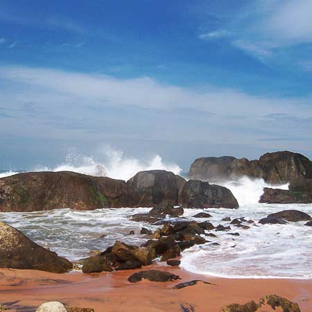
Soil in the district is mostly of the red loam variety. However on the sea coasts, the sandy type of soil prevails and, near the mountain ranges, gravelly soil is generally seen. In low lands there is neither white sand nor sandy lam, while in the midlands and high lands there prevails fairly fertile soil of the fine type. The valley in the midland has loamy clay soil with high sand content. In the midlands, in general, the soil is clay-loam of laterite origin with an admixture of gravel and sand. Laterite soil is found at Thiruvattar, Killiyoor, Munchirai, Rajakamanagalam, Thuckalay blocks. Red and alluvial soil are found at Agastheeswaram and Thovalai blocks.
The soil pH is between 4.5 to 8.0. The minerals in soil - nitrogen: low to medium, phosphorus: medium, potassium: high
48.9% of land in the district is under cultivation and 30.5% is covered by forests.
Climate
Based on a 50 year study, it is found that during the North-East monsoon, between October and December, a precipitation of 549 mm is received in 24 rainy days and during the South-West Monsoon 537 mm is received from June to September in 27 rainy days. In summer, 332 mm of rainfall is received in 11 rainy days between March and May. The annual average rainfall in the district is 1465 mm with a maximum of around 247 mm in October and a minimum of 21 mm in February. Relative humidity ranges between 60 to 100%.
Rivers
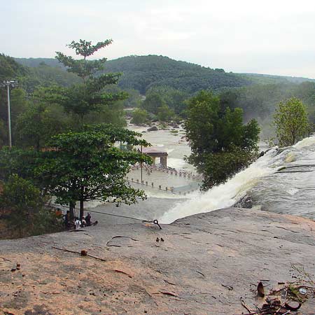
The major river in the district is Thamirabarani River locally known as Kuzhithuraiar. This river has two major tributaries with the Pechiparai Dam and Perunchani Dam respectively built across them, Kodayar and Paralayar. There are many tributaries for the Kodayar River of which Chittar River I and Chittar II, with their dams, are the major ones. The origin of Thamirabarani River is in the Western Ghats and the river confluences with Arabian sea near Thengapattanam, about 56 km. west of Kanyakumari town.
Valliar, another small river and its tributary Thoovalar, originate from the Velimalai Hills, collect the drainage from P.P. Channel and its branches, ayacuts (irrigated area under a tank) and confluence with the Arabian Sea near Manavalakurichi. The Pazhayar River, another small river, starts at Shorlacode, a place about 18 km north-west of Nagercoil. This is mainly a drainage river, mostly collecting the drainage of Thovalai, Ananthanar and N.P. Channels.
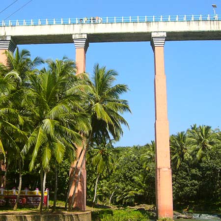
The Pahrali River also flows through the district. The Mathur Hanging Trough, the highest and longest aqueduct in Asia, was built over it near Mathur.
Forests
The forests of the district are administered through the Kanyakumari Forest Division, with headquarters at Nagercoil, the capital of Kanyakumari District.
Rainfall varies from 103 cm to 310 cm elevation from sea level to 1829 m. The forest area is 30.2% of the total district geographical area which is next to Nilgiris district with 59% and Dharmapuri District with 38% in Tamil Nadu State. 52% of the district\'s forests are classified as dense forests, which is second only to Dharmapuri District with 58%.
The Maruthuvalmalai, a hill located among green paddy fields and coconut palms, is famous for valuable medicinal plants. This is the only district in Tamil Nadu where rubber and clove plantations have been raised in reserve forests in an area of 47.857 km² and 1.1 km² respectively. The district is rich in wildlife with at least 25 types of mammals, about 60 species of birds including 14 species of migratory birds and many species of fishes, reptiles and amphibians listed.
The following are the reserve forests in Kanyakumari Forest Division:
Therkumalai East and West - 17.4 km²
Thadagaimalai - 7.9 km²
Poigaimalai - 12.4 km²
Mahendragiri - 43.6 km²
Veerapuli - 281.9 km²
Velimalai - 11.2 km²
Old Kulasekaram - 6.9 km²
Kilamalai - 8,106 ha
Asambu - 4,310 ha
